The 1901 Census
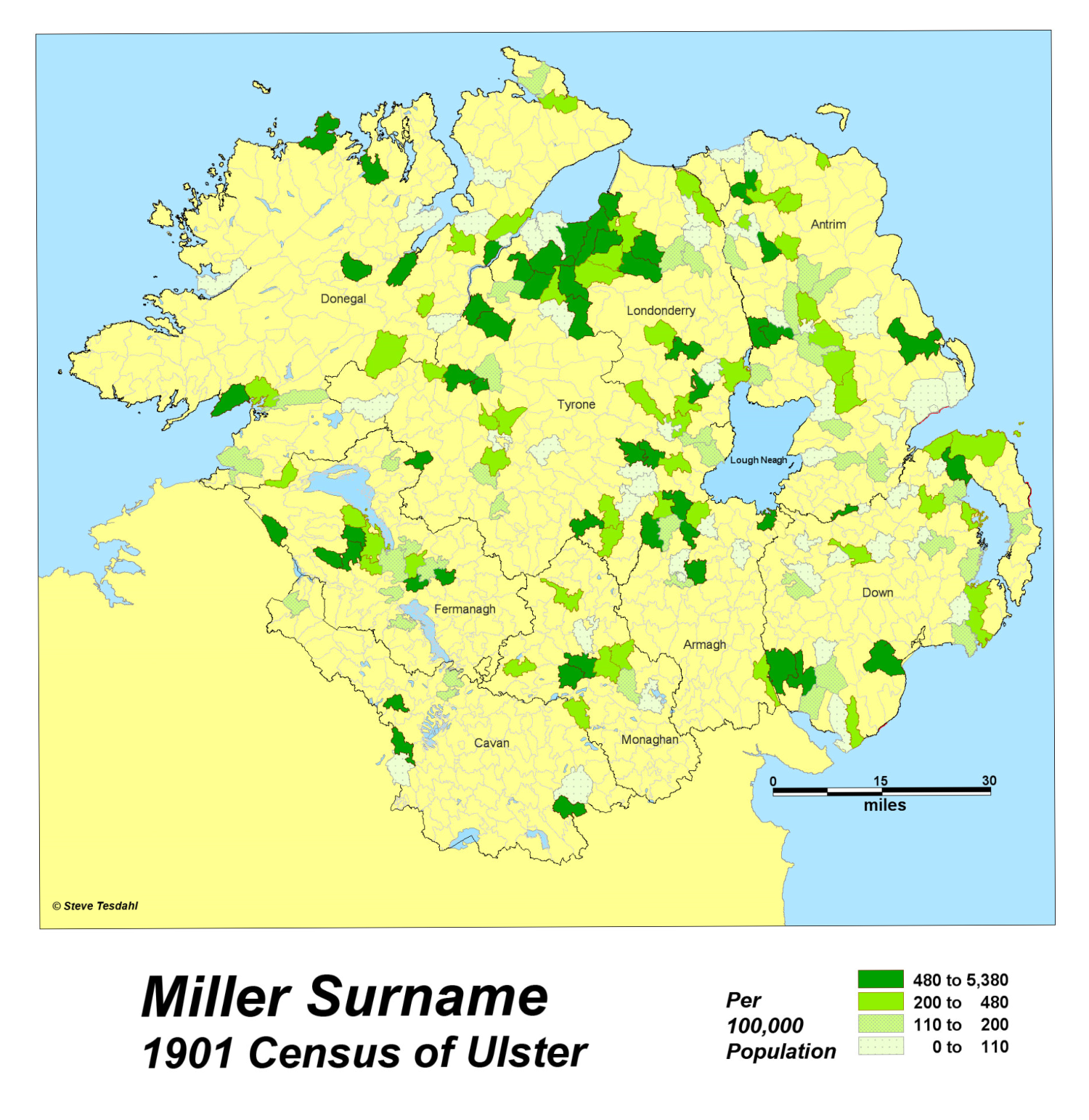
1786 individuals with the Miller surname were found in the 1901Census of Ireland. The surname was ranked the 320th most common surname in Ireland. As an occupational surname it was widely distributed throughout Ireland. However 8 of the leading 11 counties were in the Province of Ulster. Outside of Ulster its distribution can be attributed to the Norman Conquest in the 13th century. The intensity of the Miller surname can be illustrated with the Banwell Index. The District Electoral Divisions have been filtered to illustrate areas where the intensity of the surname is at least 3x the national average. In areas of NW Londonderry the majority of DED’s are between 5 - 10 times the national average. In one area the population id 32x the frequency at the national average. Just how stable are surname distributions? Stability can take generations to build. Given favourable biological, economic and environmental conditions, populations can become entrenched in an area. A measure of the surname’s stability can be illustrated by the 1630 Muster Roll. In the case of the Miller surname it is highly probable the pattern we see in the 1901 census was set down in the early 17th century with the plantation of Ulster.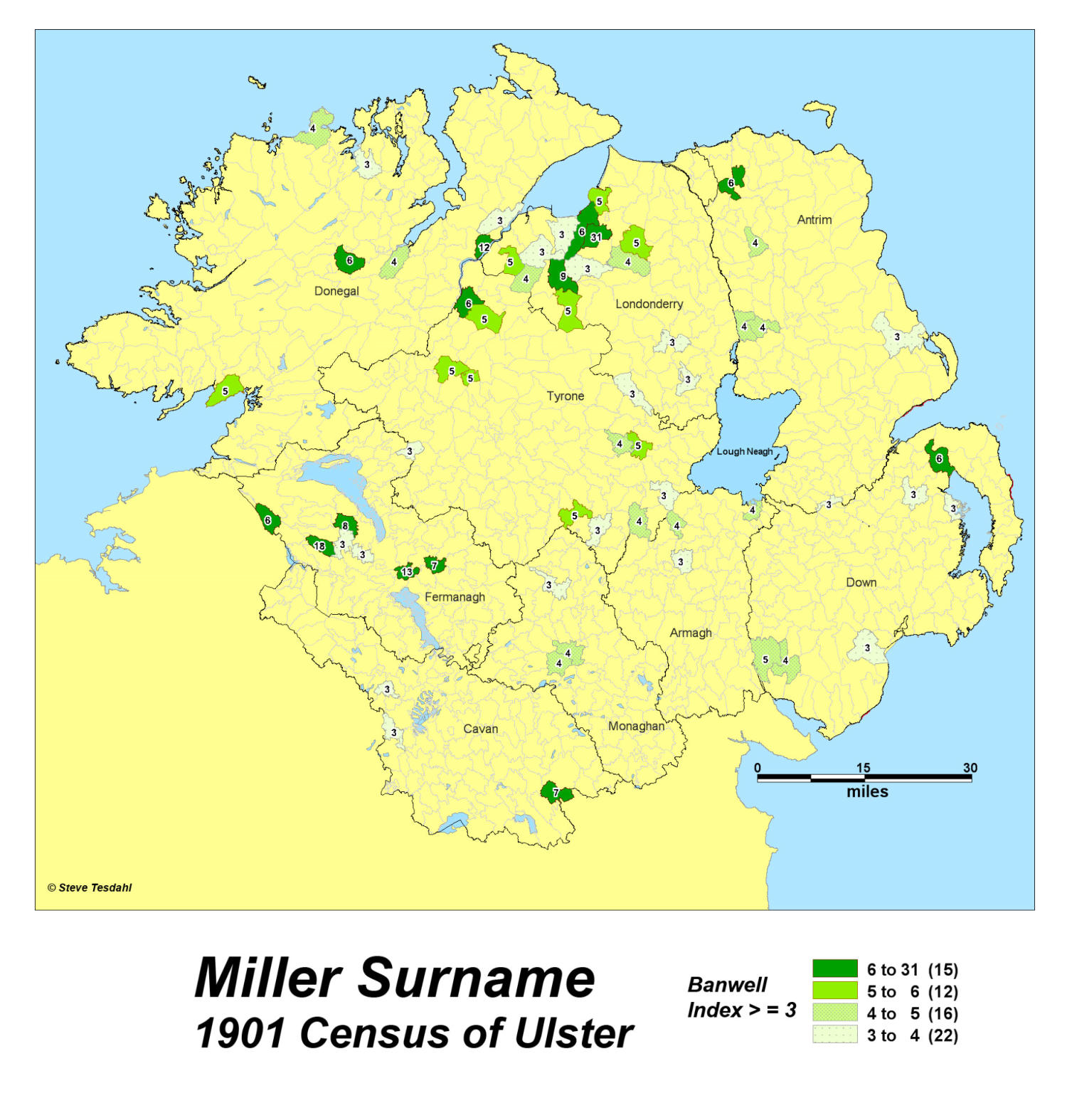
The Ulster Distribution


The Miller Surname Study


GeoGenealogy